Alberta Seismic Events – https://ags-aer.maps.arcgis.com/
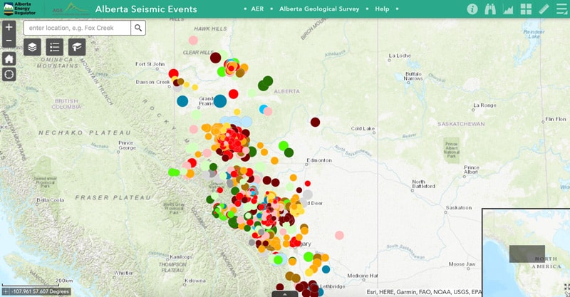
The Alberta Seismic Events interactive map displays the earthquakes in the province since 2006. Included in the list are natural earthquakes and suspected induced earthquakes (except for earthquakes that come from mining). The size of dot corresponds to the magnitude of the earthquake and the colours of the years.
Data for the seismic events comes from telemeters seismic stations from around the province and partnerships with seismic networks within Alberta and beyond. Including telemetered stations from partnering networks, there are over 38 stations monitoring for seismic activity for Alberta.

Recent Comments