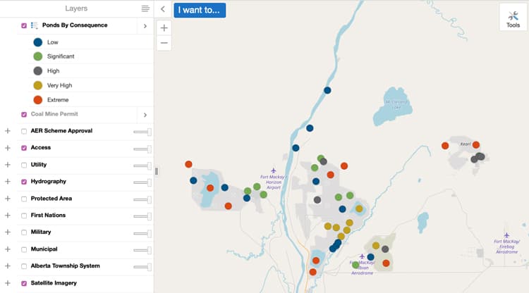
Dam and Pond Map – https://extmapviewer.aer.ca/DamSafety/index.html
From the Alberta Energy Regulator comes the dam and pond map – an interactive tool to view the locations and characteristics of ponds and dams associated to industrial projects. The map displays ponds and the sector, fluid type, capacity, dam height and a risk analysis.
The map can be filtered according to sector, fluid type, company and risk.
Explore the pond and dam map from the Alberta Energy Regulator.

Recent Comments