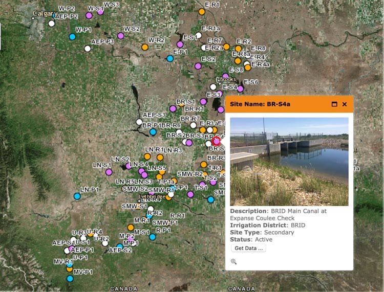
Irrigation District Water Quality Data Tool – http://www.idwq.ca
Information from the 13 irrigation districts in Alberta is collected and displayed on an interactive map – the Irrigation District Water Quality Data Tool. Information is collected from the irrigation districts, Alberta Agriculture and Forest and Agriculture and Agri-food Canada.
The goal of the map is to display the data (in the form of spreadsheets) for water quality data at various spots throughout Alberta’s agricultural regions. Water quality data assessed includes:
- Physical – temperature, total suspended solids
- Chemical – amounts of various natural and anthropogenic chemicals
- Biological – amounts of bio materials, including notable bacteria
Information collected included current and historical data.

Recent Comments