
This comprehensive report reviews the primary land use stressors along the Eastern Slopes of the Rocky Mountains in west-central Alberta. It was published in September 2018.
Download the complete report from Alberta Environment and Parks.
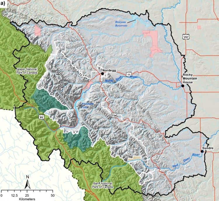
Encompassing the Upper North Saskatchewan River Basin and part of the Upper Red Deer River Basin, the study area of this report covers nearly 25,000 km2 (3.7 per cent of Alberta total land). The region covers the Eastern Slopes of the Rocky Mountains, extending to Rocky Mountain House and Sundre.
The report reviews the current state of the land use stressors on terrestrial and aquatic ecosystems within the Eastern Slopes. The land use stressors reviewed include:
- Historical, recent and future fire regime
- Forest harvesting
- Linear disturbances
- Climate variability and change
- Streamflow
In addition to improved monitoring, the report recommends environmental management strategies, such as:
- Prescribed burns
- Forest harvesting
- Silviculture treatments and harvesting after burns
- Regulate linear disturbances
- Conservation areas
Download the complete report from Alberta Environment and Parks.
Farr. D., Mortimer, C., Wyatt, F., Braid, A., Loewen, C., Emmerton, C., and Slater, S. 2018. Land use, climate change and ecological responses in the Upper North Saskatchewan and Red Deer River Basins: A scientific assessment. Government of Alberta, Ministry of Environment and Parks. ISBN 978-1-4601-4069-7. Available at: open.alberta.ca/publications/9781460140697.


Recent Comments