Using public participatory mapping to inform general land use planning and zoning – Research paper from Landscape and Urban Planning (2018)
Case study from California exploring how public participation can contribute to the land use planning process.
There is a spectrum of scopes of planning, ranging from zoning individual lots to general land use or regions plans. But all types of planning have these two components in common:
- Land is divided into spatial regions
- Regulations are applied to manage the use of the land within the regions
These steps are typically done with the guidance of government agencies, professional planners, academic advisors or researchers, or other experts.
Researchers from the United States and Australia studied another approach to inform the division of land into spatial regions. In a 2018 research paper entitled Using public participatory mapping to inform general land use planning and zoning, the researchers outline the process to create land use delineations through public participation.
Instead of top-down, the researchers suggest a bottom-up model to create spatial regions.
Participatory mapping
Participatory mapping integrates public participation with spatial data. As an emerging tool, participatory mapping and its best practices are far from standardized. The researchers suggest this process to use participatory mapping to create spatial regions for land use planning:
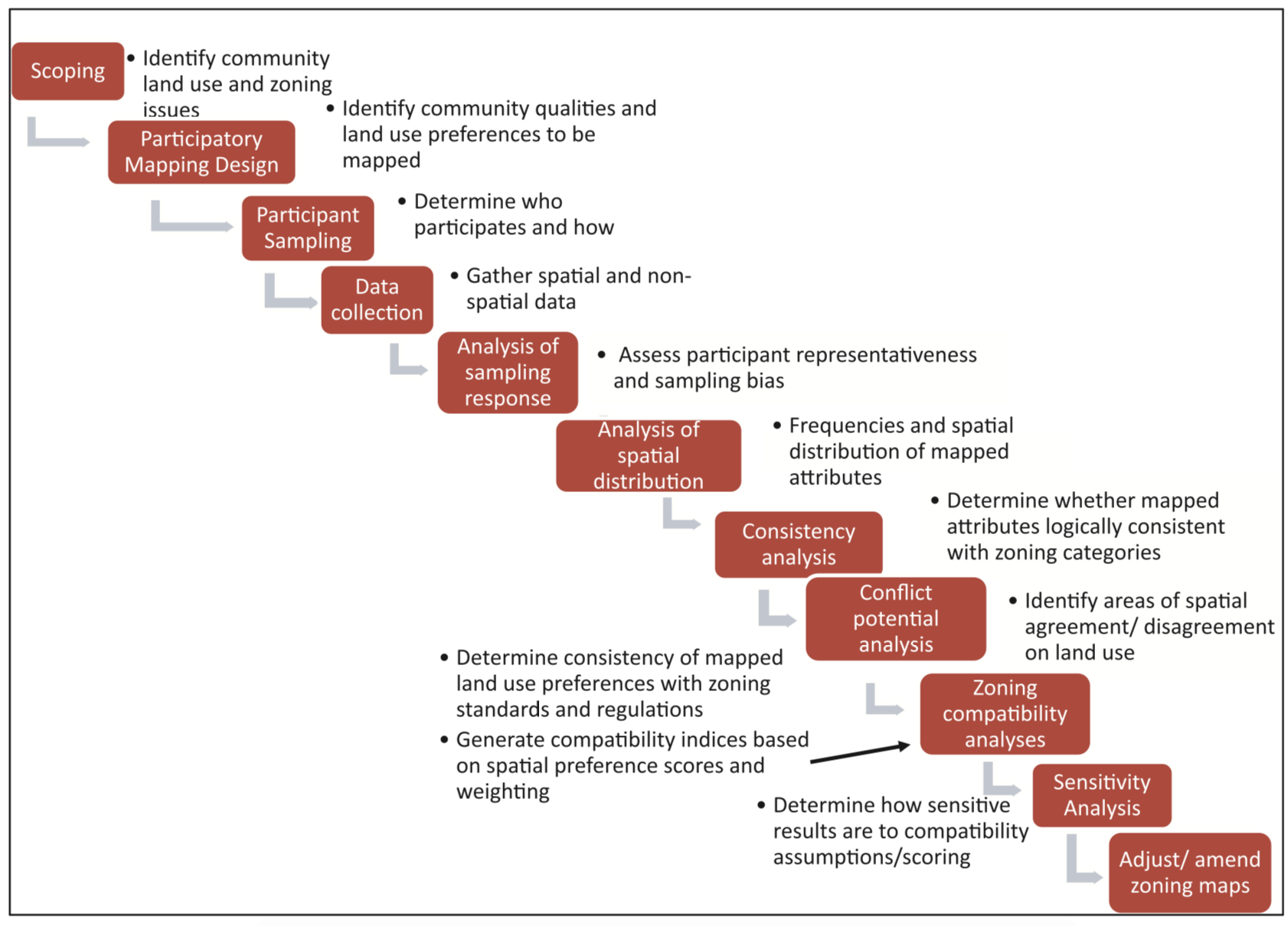
Suggested workflow for using participation mapping in land use planning
The researchers use a case study for California to demonstrate this process.
As an emerging tool in land use planning, the researchers raise some questions to consider for future research:
- What is the effect of NIMBYism to participatory mapping?
- Are the responses of the public influenced by who asked the questions? Is there more or less trust for government agencies or private firms?
- Can participatory mapping be used to trigger changes to the spatial zones or the land use regulations? Can is enable more dynamic land use planning?


Recent Comments