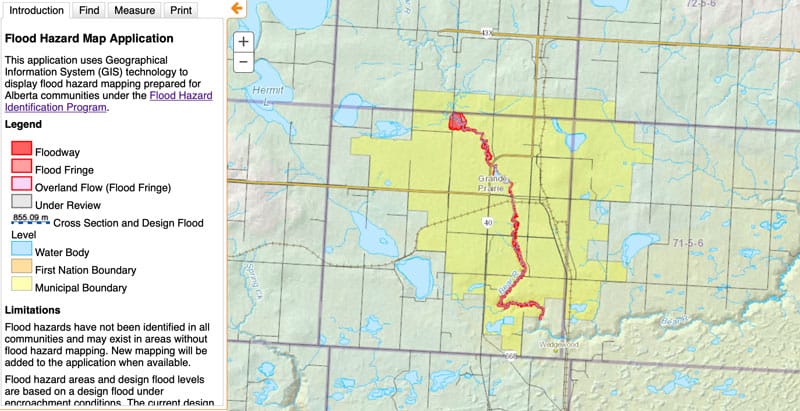
Flood Hazard Map – http://maps.srd.alberta.ca/FloodHazard/
Online map to visualize the regions in Alberta that have a risk of flooding. View the online map.
The interactive map displays the regions in the province along water bodies that have a risk, according to 100-year flood standards. The information comes from flood mapping studies, which identifies regions that occupy floodways and flood fringes. More information about the map, including definitions and GIS downloads.

Recent Comments