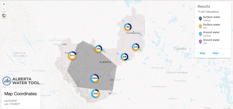
Alberta Water Tool – https://alberta-watertool.com/app/watershed
The Alberta Water Tool is an interactive map with accurate and free information from 30,600 surface and groundwater allocation points. All data has been sourced and reviewed to ensure it is accurate and accessible. New information is constantly being added.
Use the Alberta Water Tool to view streamflow data and watershed reports, including downloadable PDFs for individual water basins. This data is useful for local decision makers to understand the historical and real-time data of water basins.

Recent Comments